
< Back
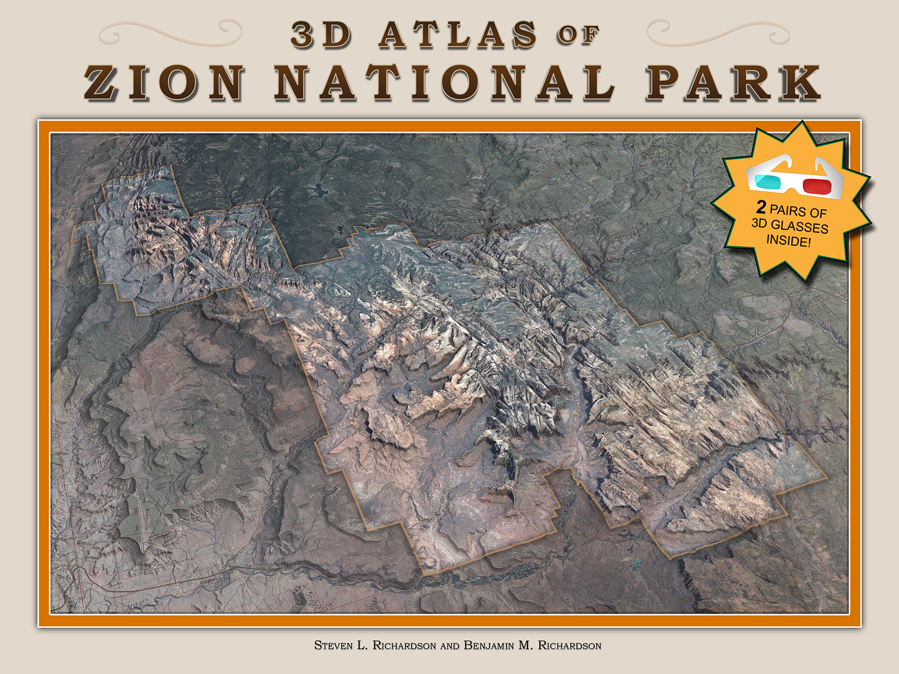
3D Atlas of Zion National Park
12" x 9"
86 pages, includes 2 pair red/cyan glasses
$29.95 + shipping
Located near the southwest corner of Utah, Zion National Park is best known for its spacious Zion Canyon, a broad valley walled by rugged red and white sandstone cliffs. The scene is beautiful in pictures, but there is much more to be experienced by anyone who goes there in person. There you may find deep narrow canyons, lofty waterfalls, rushing streams, tranquil pools of water, soaring stone arches, mysterious Indian ruins, peaceful groves of trees, abundant wildlife, star-studded night skies.
The scenery is a result of a long chain of geologic events—a vast ancient shallow sea gradually replaced by a great desert of shifting sand dunes, which were later covered again by the sea, followed by uplifting, jointing, erosion, and volcanism. Each of these processes sculpted the park's unique features, which combine to become one of Nature's masterpieces.
Long before it was discovered by Europeans, the canyon was known and loved by the Southern Paiute tribes of Indians, who called it I-oo-goone, which means "rock canyon like an arrow quiver, with only one entrance." In 1776 an expedition led by Dominguez and Escalante, two Catholic Franciscan Fathers, explored the region while trying without success to find a route from New Mexico to California. Trappers and emigrants later passed by on their way to California, but none of these were looking for scenic wonders, and the canyon remained unknown to them.
The first non-Indian to enter the canyon was a Mormon explorer named Nephi Johnson in 1858 while looking for places to establish settlements. In 1863 the area was settled by Mormon pioneers, who farmed and ranged cattle in the main canyon. They called the place Little Zion. The word has Hebrew origins, but in Mormon theology, Zion is a place where good people can gather and dwell in peace. Frederick Vining Fisher, a Methodist minister from Ogden, Utah explored the canyon in 1916 and was so impressed by what he saw that he bestowed the features with names rich in religious imagery, including the Three Patriarchs, Angel's Landing, and the Great White Throne.
With its high vertical walls and plummeting waterfalls, government explorers quickly recognized the similarity of this canyon to the famous Yosemite Valley in California, though each was formed by completely different geological forces. In 1909 US President William Howard Taft designated the area as Mukuntuweap National Monument. The name was changed to Zion National Monument in March 1918. Congress made it a national park in November 1919. In 1937 a separate Zion National Monument was created to protect the Kolob canyons to the north; the boundaries of the park were expanded in 1956 to include that area. In 2010 the park had 2,665,972 visitors, the vast majority of whom visited only Zion Canyon, which is just a small portion of the park. Few people are lucky enough to visit every portion of the park, so this book has been prepared to give you some idea of what you can expect in the places you do visit, and to allow you to ponder what else the park has to offer.
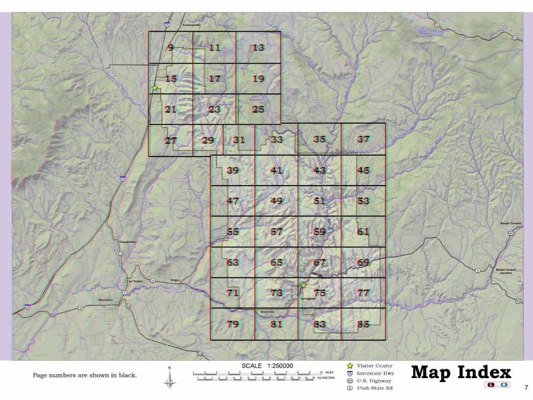
The maps within this book are presented as anaglyphs, which are currently the best way to easily present large three-dimensional maps in print format. A turn of the page will reveal two views of the same area. One was made from an aerial photograph, while the other is from a topographic map. The index map (shown above) should give some idea of what area each of the maps covers, and it also indicates where in the book to look for maps of adjacent areas. A number in a black triangle at the top and bottom of most sheets will also let you know which page to turn to if you want to see adjacent maps to the north or south. Each sheet overlaps its neighbors by 1/4 mile (1320 feet or 402 meters). You can see an example of the open book in the image below.
The inside cover has a pocket containing two pairs of 3D anaglyphic glasses. You should view the maps in this book while wearing the glasses, with the red lens over your left eye. We recommend that the anaglyph glasses only be worn when you are looking at the maps. If you wear the glasses for long periods of time your eyes may have a temporary difficulty adapting to natural colors when you remove them. If you wear prescription glasses, you may be able to wear the anaglyph glasses over or under them. You should avoid touching the lenses of these glasses and attempt to keep them clean. Some people are unable to see 3D. Unfortunately this book will be of little benefit to them.
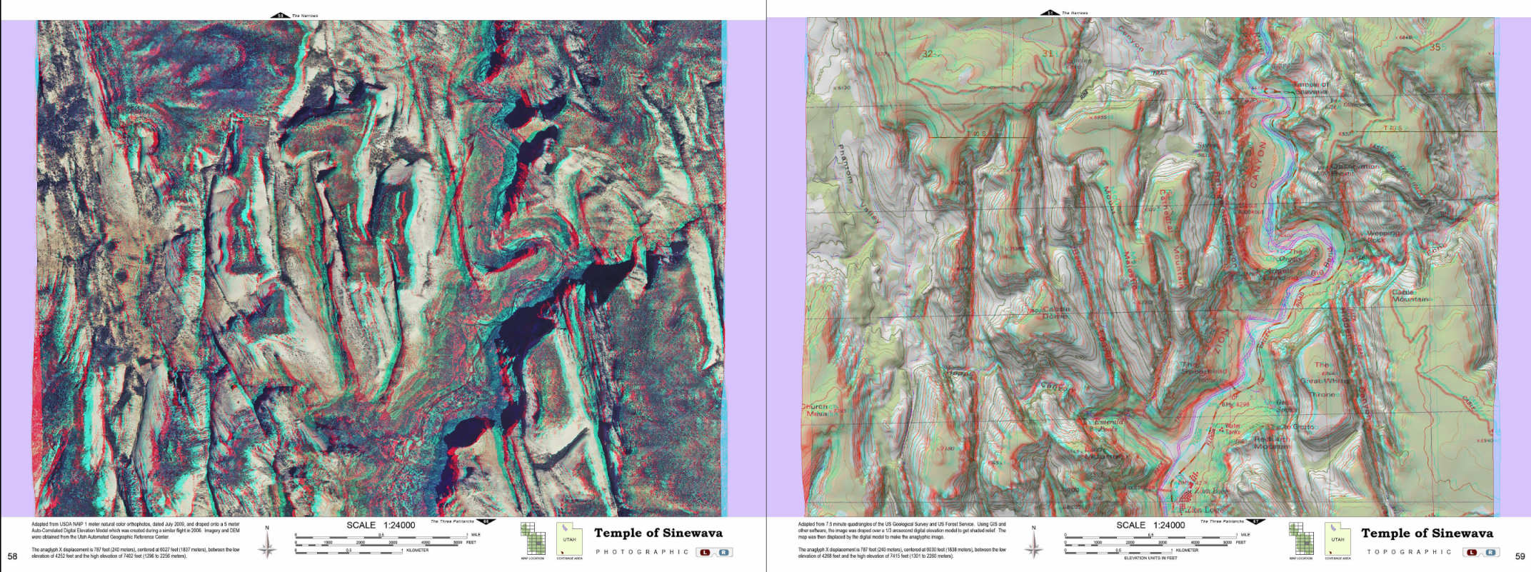
Each map page is actually two maps that are printed on top of each other in contrasting colors. Though they cover the exact same area, the maps are not identical. If you look at the page through the red lens, you will see one of these maps. The opposite of red is cyan, and through that lens you will see the other map. If you look at the left and right borders of the map you can see that both images have been distorted to the right or left to resemble perspective views. The cyan image is only visible through the red filter, and the red image is only visible through the cyan filter. That’s the ideal case; the filters and inks used in printing the anaglyphs don't work together perfectly, so it should be normal to see a faint ghost image, especially in areas of high contrast. The colored plastic filters allow only a part of the visible spectrum to reach your eyes, so the 3D effect will be easiest to see if you view the maps in a well-lit area.
The vertical scale is an approximation, based on a page that is viewed from 10 inches away, by eyes that are 2.5 inches apart. Since the maps are at a scale of 1 inch to 2,000 feet, this is similar to what you would see if you were a giant with eyes that are 5,000 feet apart, looking vertically down on the area from a distance of 20,000 feet above the highest point. As you view the page from farther away you will notice the relief becomes more pronounced, and you should be able to settle on a preferred distance from which to view the page.
Zion National Park is one of the most majestic of the US national parks, and one of the world's special treasures. We hope that those who use this book will find it useful, even enjoyable. It gives a good idea, at a glance, of the rugged topography that can be found in the park. You should be aware that there are many hazards that the map can't depict, and the ultimate responsibility for any decision you make or route you take is yours. Please be careful as you plan your visits to Zion so that when you leave, you will take happy memories with you.