< Back
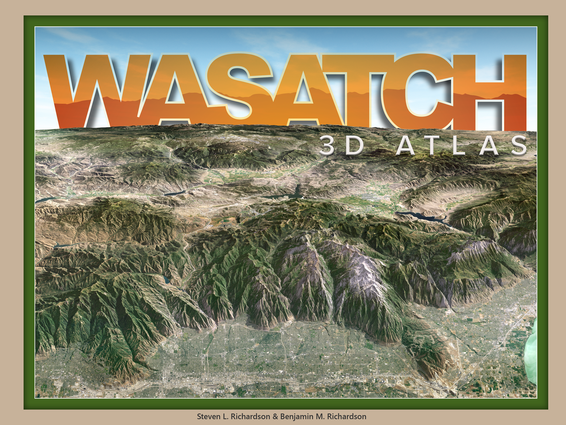
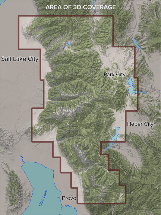
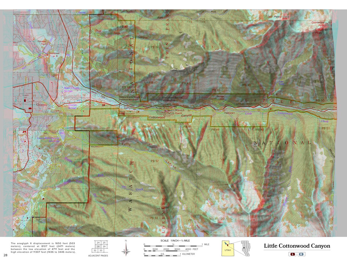
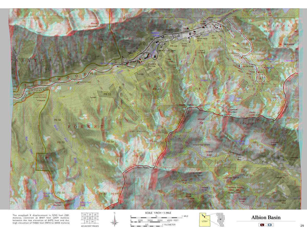
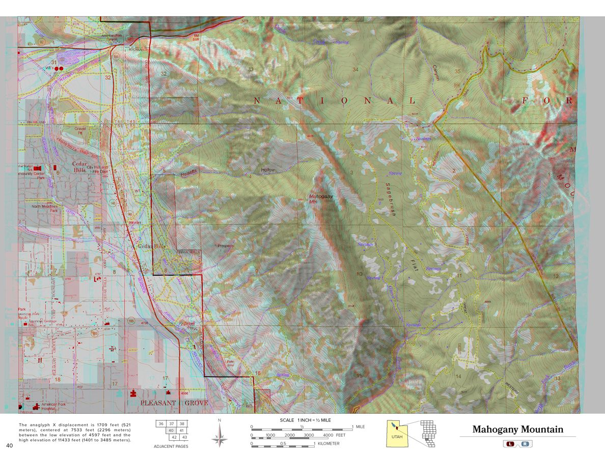
Wasatch 3D Atlas
12" x 9"
48 pages, includes 2 pair red/cyan glasses
$24.95 + shipping
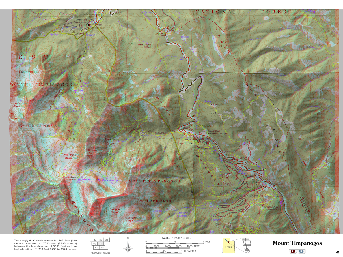
Experience the Wasatch Mountains like you've never seen them before! Explore the awesome topography of every ridge, cliff, hiking trail and ski area from Salt Lake City to Park City to Provo. Peaks rise above the page in eye-popping 3D, while canyons descend below.Using their deep understanding of photogrammetry, cartography, and computer graphics, Steve and Ben Richardson transform US government maps into a one-of-a-kind map experience to delight geologists, outdoor enthusiasts, and armchair explorers alike. View the Wasatch landscape from the comfort of home or use this book to navigate your next Wasatch adventure. "I was mesmerized. What a great way to recon a trip, plan a route, and get an overview."– Patrick Cone, National Parks Traveler "The 3-D atlas is like having the Wasatch Mountains in your living room. Up close and personal. Just put the magic spectacles on and enjoy."– Ken Sanders, Ken Sanders Books "For those of us who live in and love the Wasatch Mountains, here is a new book that allows us a true birds-eye view! From City Creek Canyon in the north to Provo in the south, put on a pair of the 3D glasses that accompany the book and see the topography as never before! Outdoor adventurers will love this book and it's also perfect for the armchair traveler. Love it!"– Anne Holman, The King's English Bookshop